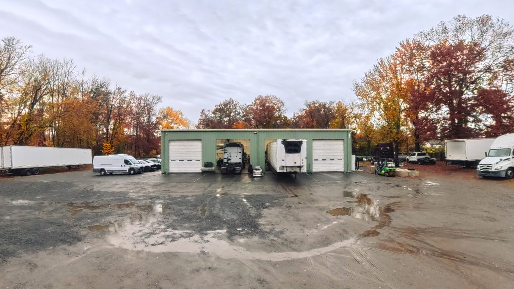
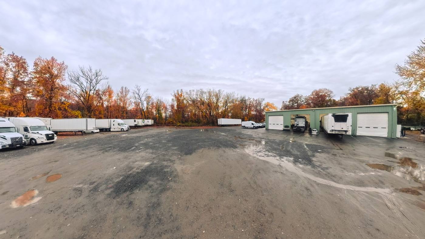
A working base with room to operate
The facility is built and in use today. The site gives a buyer a maintenance building, usable yard space and highway access in one package.
Turnkey facility
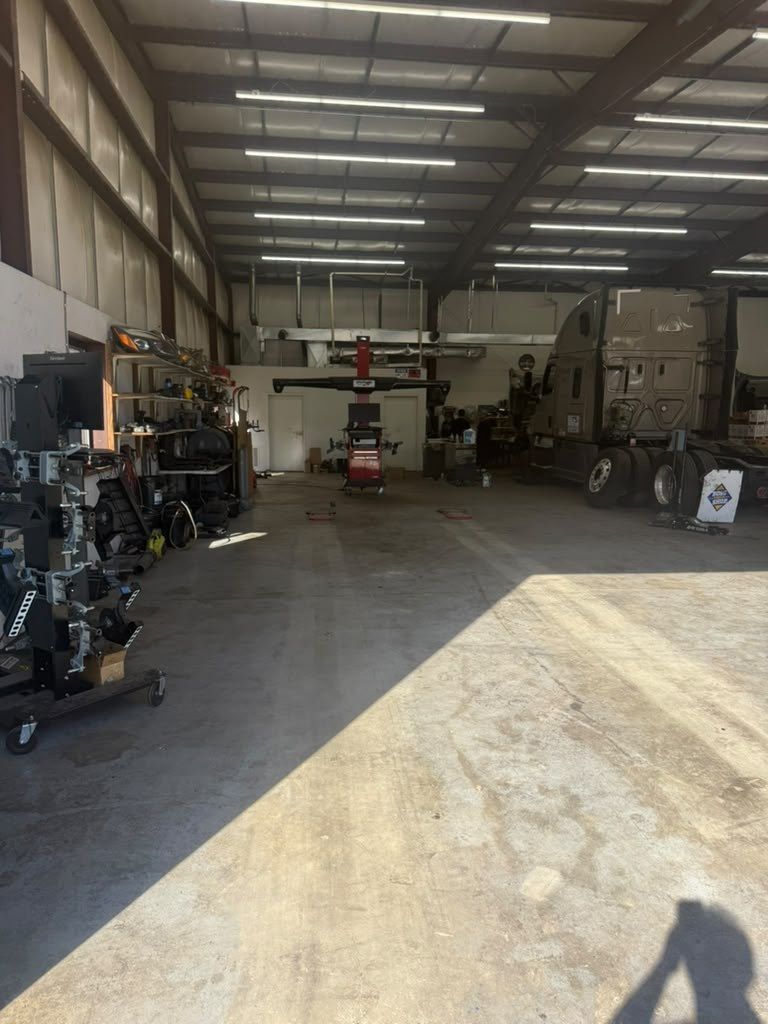
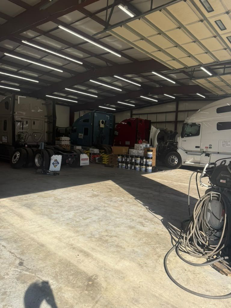
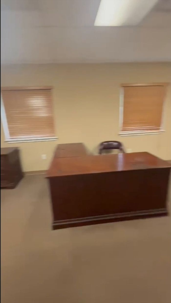
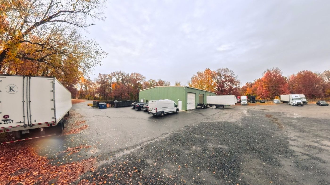
Four roll-up bays, a high-bay maintenance area and about 800 SF of office in a 2003 steel building.
3.5 usable acres
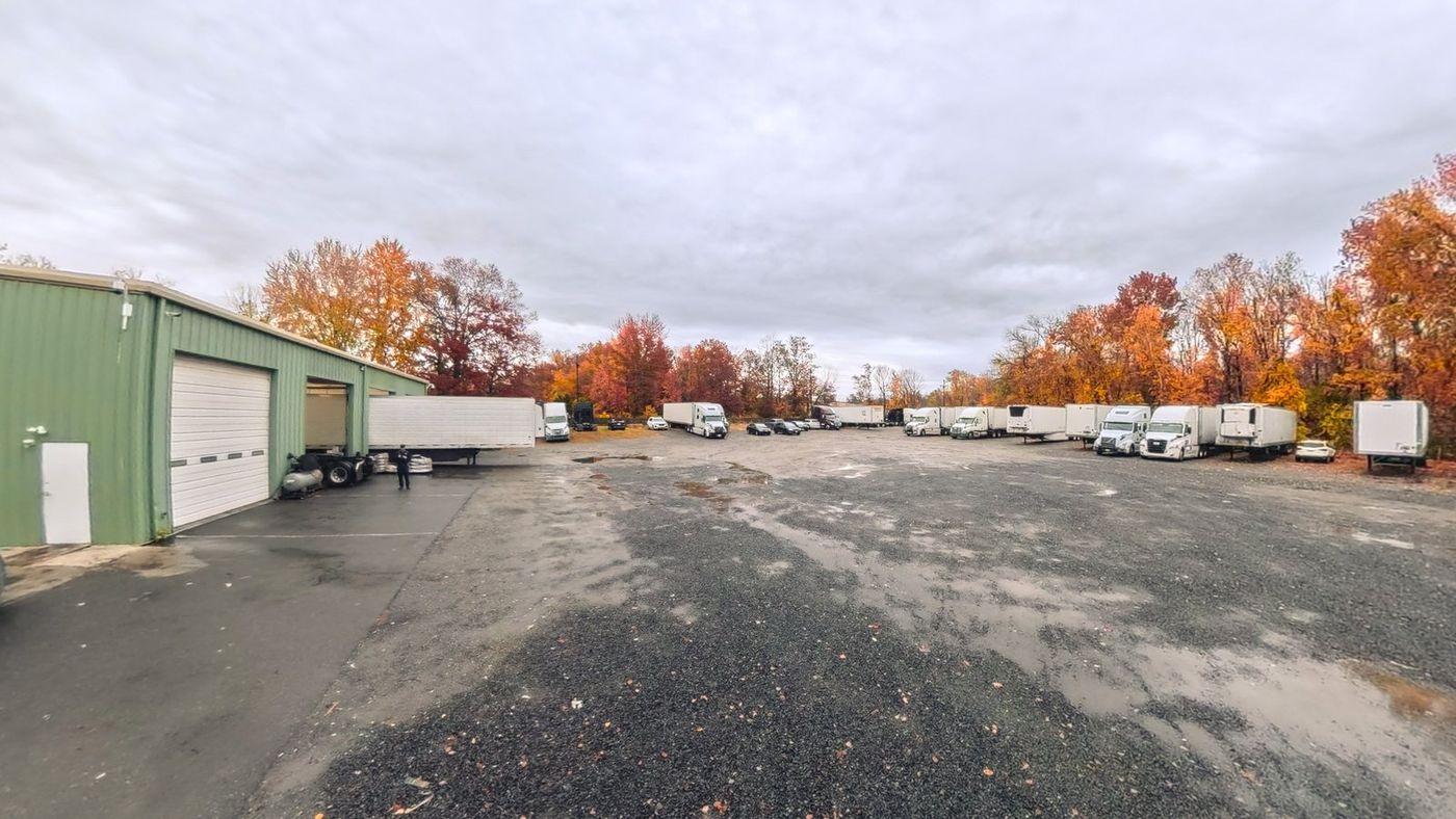
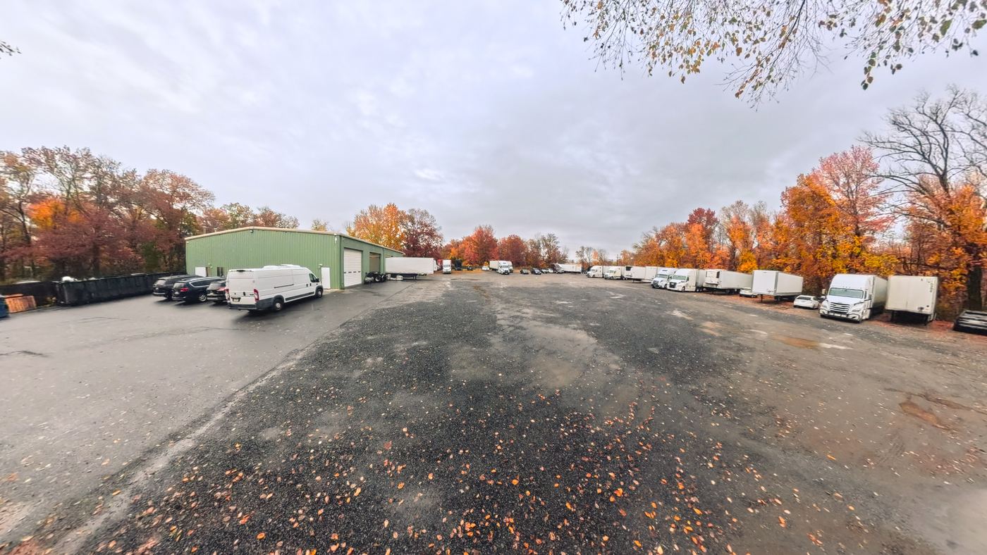
A large laydown yard for trucks, trailers, equipment and materials, plus 1+ acres of uplands near the front for expansion.
Flexible I-3 zoning
Contractors, light manufacturing, wholesale and distribution are permitted. Contractor storage yards are a conditional use.
Highway and bridge access
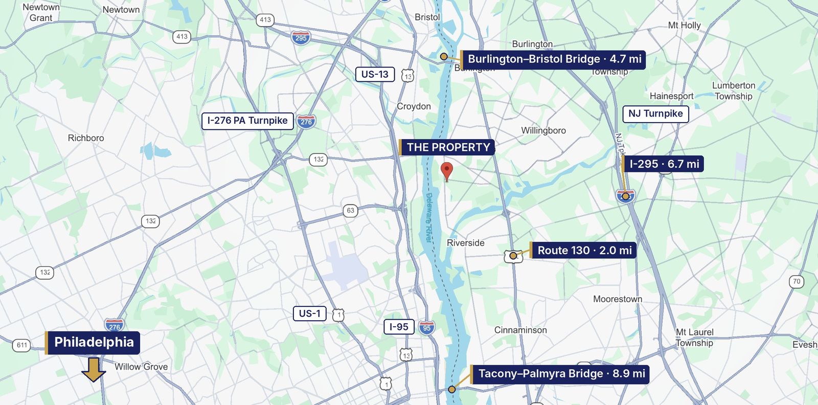
Route 130 in 2 miles, the Burlington-Bristol Bridge in 4.7 and I-295 in 6.7, with Philadelphia markets within reach.
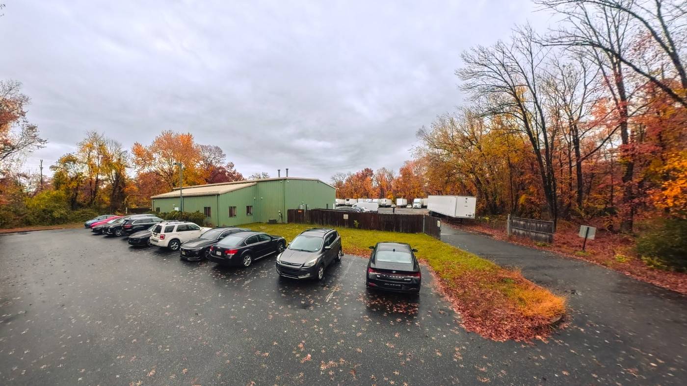
Four bays, high-bay shop and office under one roof
A one-story pre-engineered steel building with a metal roof and concrete floors, built in 2003.
- Building size
- 6,673 SF, one story, about 21 ft high
- Construction
- Pre-engineered steel frame, metal roof
- Layout
- High-bay shop and maintenance area, about 800 SF of office
- Doors
- 4 roll-up bays
- Year built
- 2003
- Floors
- Concrete
- Parking
- 11 spaces (10 regular, 1 accessible)
- Current use
- Contractor shop and storage yard
Building size is per the ALTA/NSPS survey. Other reports round to 6,700 SF and the original site plan shows 6,500 SF. Buyers should verify all measurements.
3.5 usable acres, ready to work
The parcel totals 15.1 acres. The usable working area sits at the front of the site, with the remaining land made up of wetlands and woodland.
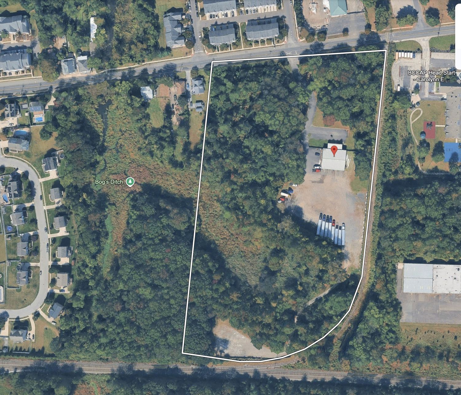
- Paved apron at the building and a large laydown yard with gravel storage areas, fencing and a gate
- Approved site plan in place for a contractor's office, shop and yard
- Room to expand on the uplands near the front
- Direct access to a public road, with about 607 ft of frontage
- Private access to an additional rear yard and laydown area
- Total site
- 15.12 acres (658,606 SF) per ALTA/NSPS survey, two contiguous parcels
- Usable area
- About 3.5 acres (broker estimate, not surveyed)
- Frontage
- 607 ft, lot depth about 790 ft
- Building coverage
- About 1% of the site
- Utilities
- Public water and gas in the street and sanitary service by force main and pump station, per the original site plan. Confirm current service.
- Rail
- The Conrail Camden-to-Amboy mainline runs along the southeast boundary; a railroad right-of-way crosses the site on the survey.
Usable acreage is an approximation from the broker's property sheet. The assessor lists 15.42 acres and the survey 15.12 acres. Buyers should confirm buildable area with their own survey and engineer.
I-3 Modified Industrial District
The I-3 district (Township code section 110-37, added July 2023) allows a wide range of industrial and commercial uses and applies the I-1 area and bulk standards.
Modified Industrial District
Same area and bulk schedule as I-1, with its own use list. The existing property meets every standard in the table below.
Permitted uses
Conditional uses Township approval required
Listed for the I-3 district in section 110-10. General warehousing and general distribution are not on the I-3 permitted list.
Area and bulk: required vs. existing
| Standard | Required | Existing |
|---|---|---|
| Minimum lot area | 5 acres | 15.12 acres |
| Lot width / depth | 500 ft / 400 ft | 607 ft / 790 ft |
| Front setback | 150 ft | 308.8 ft |
| Side setback | 100 ft | 112.4 ft |
| Rear setback | 100 ft | 593.5 ft |
| Building height | 45 ft / 3 stories | 21 ft / 1 story |
| Lot coverage | 35% building, 70% impervious | 1% |
| Parking | 3 spaces | 11 spaces |
Contractor storage yard standards (section 110-10J)
Conditional use standards for contractor yards include an 80,000 SF minimum lot, 10 ft building setbacks and a 30 ft storage setback in front, stored goods no higher than 15 ft, a solid 8 ft fence and gate, and paved storage draining to an oil separator and stormwater system.
Maximum lot coverage is 60%, with a 30% building to 70% outdoor storage area ratio, and loose materials only in the rear yard. Buyers should confirm with the Township how the existing yard meets these standards for their intended use.
Operating limits
Operations must be indoors, with no operations or truck loading between 11 p.m. and 7 a.m.
Approved site plan
The Willow Acres, L.L.C. site plan approved a contractor's office, shop and yard on this site. It shows a 6,500 SF vehicle storage garage with 1,000 SF of office and 5,600 SF of shop, 11 parking spaces, site lighting, and stone-covered storage areas to the west and southwest plus trailer storage.
A limit-of-disturbance line keeps development out of the wetlands, with wetland buffer plantings and a stone infiltration trench. No variances or special permits have been granted.
Neighboring zones
North: WFD-AH Waterfront Development / Affordable Housing. South: R-4 Single-Family Residential. East: I-1 Light Industrial. West: outside the municipality.
What the zoning reports say
A zoning report dated Jan 31, 2025 analyzed the site under the I-1 Light Industrial District and found it conforming on use, setbacks, height, area, density and parking. The Township has since provided the I-3 ordinance, which uses the same area and bulk schedule but a different use list.
The Township has no certificate of occupancy on file for the building; the zoning officer has said that is not a violation. A zoning verification under I-3 is recommended before closing. Buyers should confirm permitted and conditional uses with the Township.
Stand in the yard
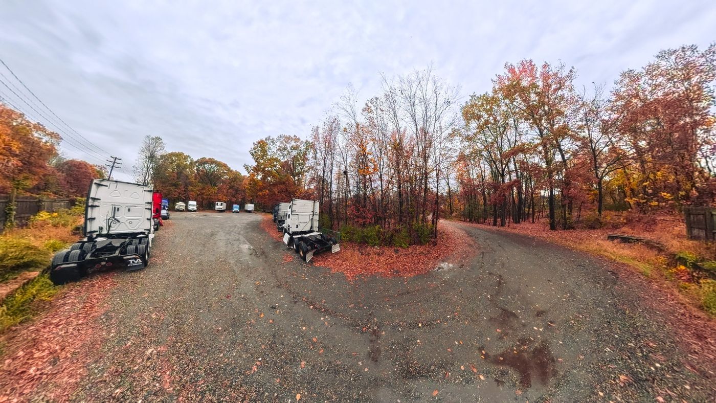
Look around from three spots on the property: the paved drive and parking, the yard directly behind the maintenance facility, and the far rear of the site.
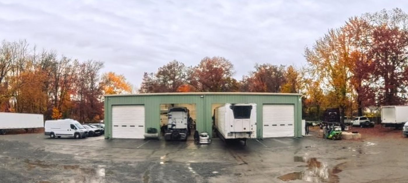
Panoramas shot in November 2026. License plates are blurred.
Property Condition Assessment
The Property Condition Assessment (Jan 22, 2025) rates the property good overall, with adequate maintenance and at least 35 years of remaining useful life.
| Item | Finding |
|---|---|
| Structure and roof | Good. Pre-engineered steel frame and exposed-fastener metal roof, with no active leaks. |
| Immediate repairs | $2,000 for fence maintenance. |
| 12-year reserves | $75,650, mostly HVAC replacement and exterior maintenance. |
| Site improvements | Drive and yard, gravel storage areas, fencing and gate, 11 parking spaces. |
| Fire protection | Hand extinguishers. No sprinklers or fire alarm were observed. |
This section summarizes the Jan 2025 assessment. It is not an appraisal of value. Buyers should rely on their own inspections and advisors.
Clean Phase I, with wetlands mapped and kept out of the way
The Phase I Environmental Site Assessment (ASTM E1527-21, Jan 22, 2025) found no recognized, controlled or historical environmental conditions and recommends no further investigation.
Wetlands on the west side
About 7.1 acres of wetlands are mapped on the west side of the site. The ESA lists them as a business environmental risk. A wetland study would be needed before any development there.
Acreage per the Phase I ESA. Bar segments are drawn to scale of the 7.13 mapped acres.
- Development is kept out of the wetlands by a limit-of-disturbance line on the approved site plan, with wetland buffer plantings and a stone infiltration trench.
- Wetlands boundaries were verified by NJDEP in a letter of interpretation dated July 9, 2004.
- Site history is farmland and marsh until the shop was built in 2003. No tanks or drums were treated as recognized environmental conditions.
- The ALTA/NSPS survey found no encroachments, landfills or earth-moving work.
Flood zones
Per the survey, the property lies in FEMA Zones X, X-shaded and AE, and is partly in a Special Flood Hazard Area. The original site plan shows the 100-year flood elevation at 11.0 ft. The building sits near the road on the east side of the site.
Report dates and updates
The Phase I ESA and the Property Condition Assessment are both dated Jan 22, 2025. A Phase I generally needs updating after 180 days for a buyer to rely on it for liability protection, so an update should be expected as part of a transaction.
NJDEP status
There are no outstanding NJDEP items on the property, per the ownership group. Buyers should confirm during due diligence.
Route 130 in two miles, Philadelphia within reach
The site connects to the regional highway network and to the Pennsylvania bridges.
Distances are approximate, per the broker's property sheet.
See it before you visit
Two short videos cover the inside of the building and the drive to the site.
Walk the Building
Inside the four-bay maintenance facility. Opens on YouTube.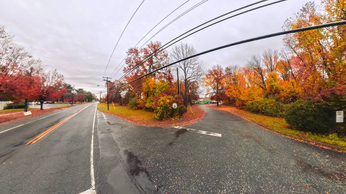
Drive the Site
Approach, yard and rear access. Opens on YouTube.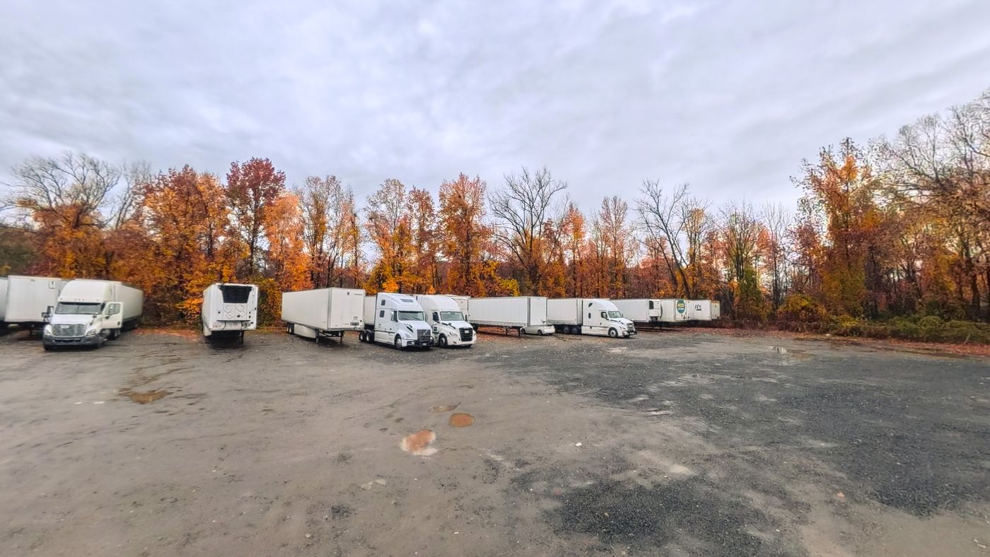
Reports and materials
The ALTA/NSPS land title survey is available now on request. The reports below are provided once the property is under contract.
Available now on request Ready
- ALTA/NSPS land title survey
Provided once under contract After contract
- Phase I Environmental Site Assessment (Jan 2025)
- Property Condition Assessment (Jan 2025)
- Zoning compliance report